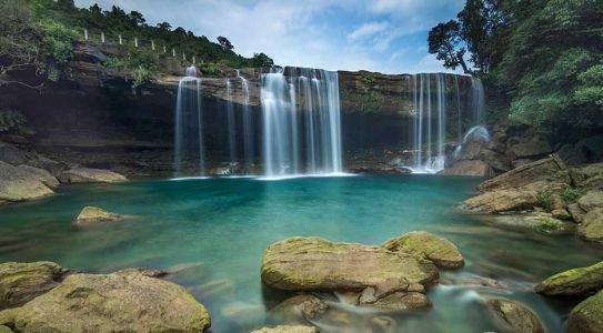
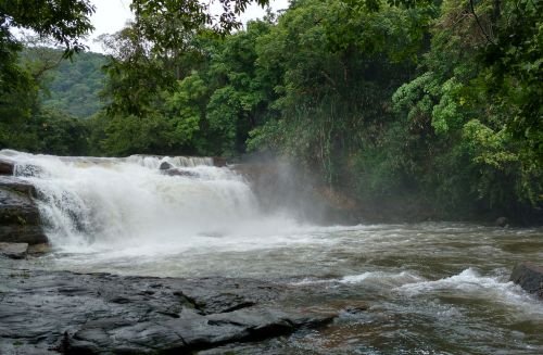
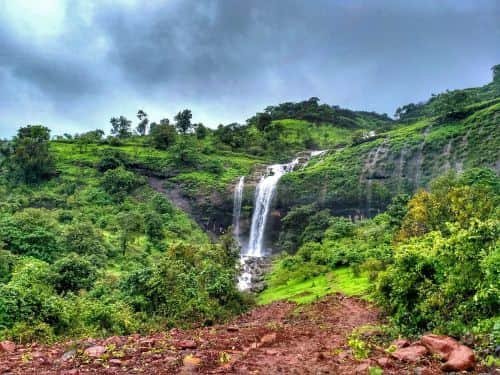
Kune Waterfalls is the tallest waterfall in the Lonavala–Khandala valley, but these days almost everyone sees it from the other side of the valley. The falls drop about 200 metres in three tiers near Kune village, between Lonavala and Khandala. The land around them is now private property, so visitors can no longer walk to the base the way older travel guides describe.
That doesn’t make the trip pointless. In the monsoon, Kune is one of the best sights along the old Mumbai–Pune highway. You just need to know where to stand, when to go, and which older advice to ignore.

Kune Falls: Quick Facts
- Location: Kune village, Lonavala–Khandala valley, Pune district, Maharashtra
- Height: about 200 m (660 ft) in three tiers; the longest single drop is about 100 m
- Ranking: listed as the 14th-highest waterfall in India by the World Waterfalls Database, as cited by Wikipedia
- Altitude: about 622 m
- Access: the approach and the area near the falls are private property; visitors watch from viewpoints
- Entry fee: none for viewing from public viewpoints
- Viewing hours: daylight; most listings say about 6 AM – 6 PM
- Distance from Khandala railway station: about 2 km
- Distance from Lonavala railway station: about 3.5 km
- Distance from Pune: about 70 km
- Distance from Mumbai: about 83–94 km
- Best time: July to September; it’s thinner but still visible in early October after good rains
Can You Still Visit Kune Falls Up Close?
Mostly, no. Since around 2018, visitors have repeatedly reported that the land around the falls is private and closed to the public. Here’s what they’ve found:
- Gated entry: the entry point is now a private, gated area, and locals advise visitors not to try to walk in.
- Ownership: several reviewers say the property belongs to a Catholic mission. Kune Church, near the falls, has long been the main landmark for finding them. We couldn’t confirm the owner from an official source.
- Hotel guests: one reviewer suggested that access might only be possible for people staying on the property. That’s unverified, so don’t plan your trip around it.
- Trespassing: at least one visitor admitted sneaking in early in the morning. Don’t do it. It’s private land, and the rocks near a 200-metre drop are no place to take risks.
Ignore the outdated advice: many websites still say you can swim in the pool at Kune or rappel down the falls. Those descriptions date from before the access closed. Treat any guide that promises swimming at the base as outdated.
Three Tiers and 200 Metres of Water
In a strong monsoon, the water spills off the plateau above Kune village, drops in two long stages, then breaks into a third, shorter cascade before disappearing into the forest below. The biggest single drop is about 100 metres, about the height of a 30-storey building.
According to one source, the valley below Kune drains toward the Ulhas River side of the ghats. This west-facing slope of the Sahyadris is why the falls look so dramatic in the rains and so bare in winter.
Kune is mainly a monsoon waterfall. Visitors who came after dry spells report barely any water, and some missed the falls altogether. If it hasn’t rained for a week or two, expect a thin, broken stream.
Best Places to View Kune Waterfalls
Since you can’t reach the base, choose your viewpoint carefully. Visitors recommend these spots along the old highway:
- Khandala viewpoints on the old Mumbai–Pune highway: several roadside pull-offs look across the valley at the full height of the falls. They’re especially striking when fog drifts through.
- Monkey Point (Khandala): often mentioned by visitors as a good place to see Kune. There are snack and tea stalls nearby, and you’ll see plenty of monkeys, so keep your food covered.
- Rajmachi Point: best known for views of Rajmachi Fort, but on clear days it also gives a wide view across the valley, including the Kune side.
Timing tip: the falls are often hidden in cloud during heavy rain. The best views usually come during breaks between showers, especially in the morning.
Kune Waterfalls Timings and Fees
Viewing from the public road costs nothing and follows daylight hours:
- Entry: free from the public viewpoints
- Timings: about 6 AM to 6 PM is a practical window
- Parking: roadside stops are informal; some nearby parking areas may charge a small fee
- Food: tea, snacks and corn stalls at Monkey Point and other viewpoints, mostly in the monsoon
There’s no ticket counter at the falls themselves, because there’s no public access route.
Monsoon Rules in Pune District
Lonavala’s waterfalls have a troubled safety record. In June 2024, five members of a family drowned at a waterfall stream behind Bhushi Dam, a few kilometres away. After that, the Pune district administration introduced prohibitory orders at popular monsoon spots around Lonavala, and similar restrictions have been used in later monsoons.
Here’s what that means for Kune visitors:
- Viewpoint closures: during heavy rain, police may restrict stopping at certain points, especially on weekends.
- Stay behind barriers: the drop below the Khandala viewpoints is sheer, and railings aren’t continuous.
- Weekend traffic: expect slow traffic on monsoon weekends on the old highway near Khandala.
How to Reach Kune Waterfalls
From Pune
Take the Mumbai–Pune Expressway, exit at Lonavala, and continue toward Khandala on the old highway. It’s about 70 km, roughly 1.5 hours. The best viewing points are on the Khandala stretch.
From Mumbai
Drive via Panvel and Khopoli, then climb the ghat to Khandala. It’s about 83–94 km depending on your starting point, roughly 2–2.5 hours without traffic. The viewpoints come shortly after you reach the top of the ghat.
By Train
Local and express trains between Mumbai and Pune stop at Lonavala, and some stop at Khandala. Kune is about 2 km from Khandala station and 3.5 km from Lonavala station. Autos are available at both.
By Air
Pune Airport is about 70 km away. On the Mumbai side, Chhatrapati Shivaji Maharaj International Airport is the main option, and Navi Mumbai International Airport, which opened in late 2025, is another, slightly closer to the expressway.
Nearby Places Around Kune and Khandala
- Rajmachi Point: views of Rajmachi Fort and the valley, close to Kune.
- Duke’s Nose: a cliff shaped like a nose, popular with trekkers and rock climbers.
- Tiger’s Leap (Tiger Point): a dramatic cliff edge with monsoon waterfalls, on the Lonavala side.
- Bhushi Dam: a popular monsoon spot. Follow all safety restrictions, given the 2024 tragedy.
- Karla and Bhaja Caves: ancient Buddhist rock-cut caves near Malavli, both protected monuments.
- Lohagad Fort: an easy monsoon trek above Malavli, often combined with Bhaja Caves.
- Amrutanjan Point: a viewpoint over the Bor Ghat and the old railway line.
- Lonavala market: famous for chikki and fudge, a natural last stop before heading home.
Practical Tips
- Plan around viewpoints: set your expectations for a view across the valley, not a dip under the falls.
- Check the rain: visit after a few days of steady rain for the strongest flow.
- Go early: reach the viewpoints by about 9 AM on weekends, before traffic and fog build up.
- Monkeys: keep car windows closed at Monkey Point, and don’t feed them.
- Binoculars: bring a pair if you have one; they make the upper tiers much clearer.
Kune Waterfalls FAQs
Q1. Can we go to Kune Waterfalls now?
A: Not up close. The area near the falls is private property and closed to the public. You can still see Kune clearly from viewpoints on the old Mumbai–Pune highway.
Q2. How tall is Kune Waterfall?
A: About 200 metres in three tiers, with the longest drop around 100 metres. It’s listed as the 14th-highest waterfall in India.
Q3. What is the best time to see Kune Waterfalls?
A: July to September, during the monsoon. The flow can still be decent in early October after good rain, but it thins quickly in dry weather.